Tenaya
March
2012
Part Four
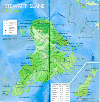
Stewart Island:
South Arm, Port Pegasus
Evening Cove
| |
| HOME |
| About Tenaya |
| About Us |
| Latest Update |
| Logs from Current Year |
| Logs from Previous Years |
| Katie's View |
| Route Map |
| Links |
| Contact Us |
![]()
March 12, 2012
Evening Cove: 47 12'.41S 167 37'.04E
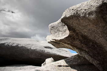
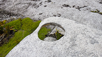
Stewart Island is very different from Fiordland. Rolling hills are dense with scrubby brush, grasses, flax and tall rimu trees and strewn with granite outcroppings. The whole island is rugged, windswept and isolated.

Maori settled on Stewart Island in the 13th century and were present as Capt. Cook sailed by in 1770 assuming it was the southern end of the South Island. Not long after Cook reported the abundance of seals in Fiordland, sealers began arriving and soon made their way to Codfish Island off the western coast of Stewart Island. Perhaps they settled there to avoid the Maori of the larger island and thus becoming a meal themselves.
Adventurous pioneers of various nationalities arrived during the 18th to 20th centuries. Sealers, whalers, prospectors, shipbuilders, timbermen and flax harvesters settled here and married Maori women, creating an interesting heritage for future generations. Eventually these industries disappeared and the bush reclaimed all traces of their existence.
What remains is an interesting mix of hearty people who have continued to survive in this harsh environment without many of the comforts of the mainland. Tourism, conservation work, and fishing for cod, paua and spiny lobster are the main interests these days.
All 400 residents of Stewart Island live in or around the only town, Oban. There are no banks or money machines and electricity costs four times that of the mainland. Only Telecom offers mobile service and it is not possible to buy a SIM card here. Daily ferry service from Bluff and air service from Invercargill bring over visitors. The small town offers more accommodation than one would expect, but there are only a few places to get a meal and one small but well-stocked grocery store. Roads lead around town but go no further. A few tracks take trampers around the northern half of the island where huts are strategically placed.
As of 2002, 85% of Stewart Island is protected as the Rakiura National Park. Rakiura is the Maori name for the island. It means "The Land of Glowing Lights" and may refer either to the beautiful sunsets or the southern lights which are often visible in the night sky. The unspoiled land and waters are a dream for hikers, kayakers, hunters and recreational fishermen.
Stewart Island is named after William Stewart, first mate of the sealing vessel Pegasus. He compiled the first detailed chart of the island's south coast in 1809.
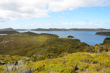
Port Pegasus lies just up from the southern tip Stewart Island on the eastern side. In contrast to the often tempestuous seas outside, it is a safe and protected body of water. There are two regions, North Arm and South Arm.
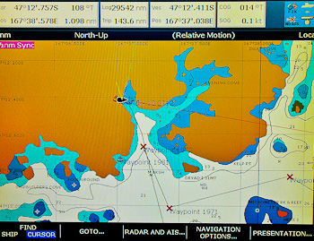
We headed into South Arm planning to stay in Disappointment Cove, the safest of the all-weather anchorages, but another yacht was already there. Instead, we went to Evening Cove which was said to be all-weather as well.
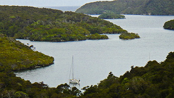
The guidebook suggests dropping the anchor and tying two stern lines to shore. We did that and settled in for a nap after our passage. Later that afternoon we looked out to see Harmony anchored nearby. That night the wind kicked up and we woke often to check that all was okay. We hadn't heard wind in the rigging for quite some time and it was a little disconcerting having so much wind on our beam.
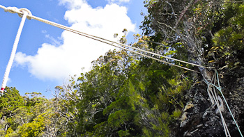
In the morning Harmony moved further into the cove and we worried we might be stretching too close to the rocks on the lee side but feared taking in any scope. As we sat in the cockpit pondering the situation, I noticed the line that had been taking all the force go slack. Jim jumped up, started the engine and steered us into the middle of the cove as I pulled in the loose line. The loop and bowline which I'd tied through a loop hanging from the tree was still in place. The existing line had broken. Thank goodness it didn't happen during the night.
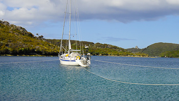
Needless to say, both sternlines were then tied around the thickest trees I could find. We added a third line off port midships for good measure as that was directly into the wind. Tenaya looked like she was caught in a spider's web but she was snug as a bug in a rug.
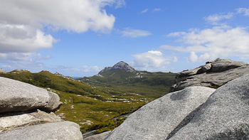
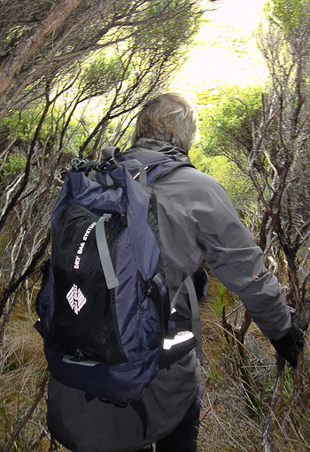
Once the weather cleared we went exploring. A track leads from the anchorage up to several granite domes. We went twice, the second time hiking to the top of the closest highpoint. We followed cairns until the base of the peak and then made our way through the dense bush from boulder to boulder until we miraculously found a track that led us to the top.
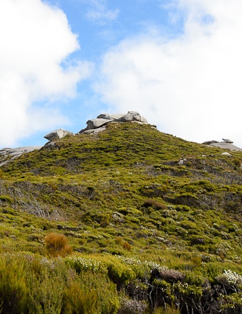
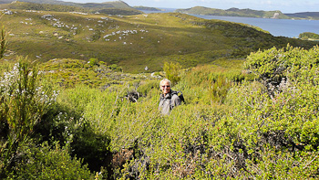
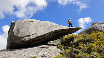
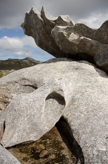
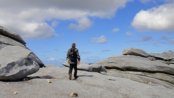
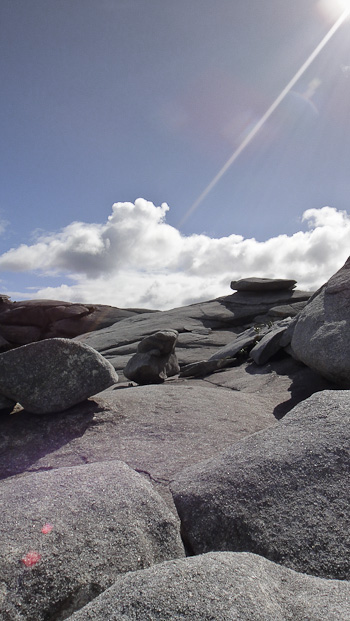
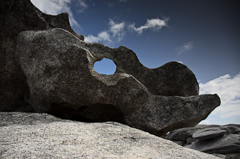
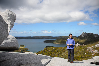
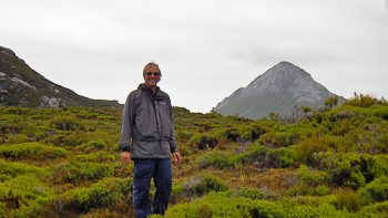
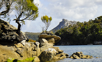
Port Pegasus is stunning. At first glimpse it seems open and mellow but on closer inspection the vegetation is often impenetrable and the landscape has been scoured by the elements. It is certainly remote and we are thrilled to be here.
Go to March 2012 Part Five - South Arm, Port Pegasus, Boat Harbour Cove